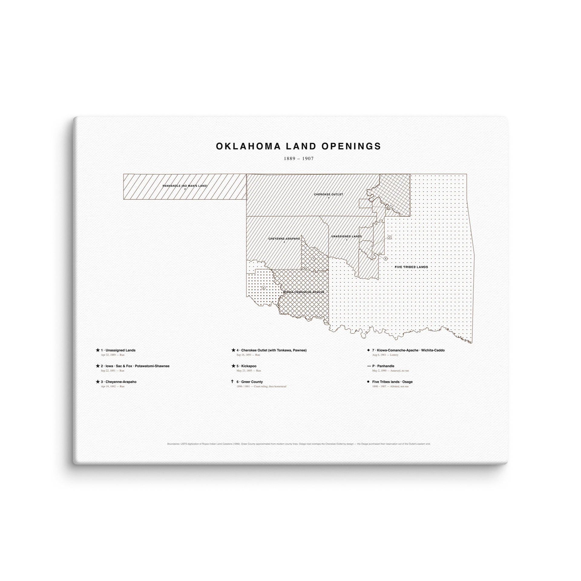
Oklahoma Land Openings Map
The whole state, every tract, one frame.
Oklahoma didn't open all at once. It came apart in pieces over eighteen years, and every piece opened a different way.
The Unassigned Lands went first in 1889, two million acres taken in a single afternoon. The Cherokee Outlet went in 1893, eight million acres and the largest land run in American history. The Kickapoo went in 1895, and that was the last run anybody ever held here.
After that the government quit racing people for it. Kiowa-Comanche-Apache went by lottery in 1901. Big Pasture went to sealed bids in 1906. Greer County wasn't Oklahoma at all until the Supreme Court said so in 1896. The panhandle never opened, it just got attached in 1890 because there was nowhere else to put it.
And the eastern half never ran once. Twenty million acres belonging to the Five Tribes, carved up allotment by allotment by the Dawes Commission instead, a process that took ten years and ended right about when statehood started.
Find your county on it. Somebody in your family showed up in one of these.
Boundaries traced from the Royce cession maps, so the lines are where they actually were.
- Acid-free, pH-neutral poly-cotton canvas stretched over a 1.25" frame
- Fabric weight 10.15 +/- 0.74 oz/yd² (344 g/m² +/- 25 g/m²)
- Sizes from 6"×6" up to 40"×60"
- Printed on demand, made to order
Part of the Forty-Sixth Star series. Every tract on this map is a story we're getting to.
More details
- Acid-free, PH-neutral, poly-cotton base
- Thickness: 1.25″ (3.18 cm)
- Fabric weight: 10.15 +/- 0.74 oz./yd.² (344 g/m² +/- 25g/m²)
EU GPSR Product Information:
- Manufacturer contact information
- Name: 46th Star
- Email: contact@support.46thstar.com
- Postal address: PO Box 5696 Santa Monica, CA 90405
- Additional information:This product is made for adults. Meets the lead level requirements. 2 year warranty in EEA and UK, established by Directive 1999/44/EC.
Quality Guarantee & Returns
- Quality is guaranteed. If there is a print error or visible quality issue, we'll replace or refund it.
- Because the products are made to order, we do not accept general returns or sizing-related returns.
Oklahoma Land Openings Map Size Guide
| Size label | Height | Width |
|---|---|---|
|
6″×6″
|
6
|
6
|
|
8″×8″
|
8
|
8
|
|
8″×10″
|
8
|
10
|
|
8″×12″
|
8
|
12
|
|
9″×12″
|
9
|
12
|
|
10″×10″
|
10
|
10
|
|
10″×20″
|
10
|
20
|
|
11″×14″
|
11
|
14
|
|
12″×12″
|
12
|
12
|
|
12″×16″
|
12
|
16
|
|
12″×18″
|
12
|
18
|
|
12″×24″
|
12
|
24
|
|
12″×36″
|
12
|
36
|
|
14″×14″
|
14
|
14
|
|
16″×16″
|
16
|
16
|
|
16″×20″
|
16
|
20
|
|
16″×24″
|
16
|
24
|
|
16″×32″
|
16
|
32
|
|
16″×48″
|
16
|
48
|
|
18″×18″
|
18
|
18
|
|
18″×24″
|
18
|
24
|
|
18″×26″
|
18
|
26
|
|
20″×20″
|
20
|
20
|
|
20″×24″
|
20
|
24
|
|
20″×28″
|
20
|
28
|
|
20″×30″
|
20
|
30
|
|
20″×40″
|
20
|
40
|
|
20″×60″
|
20
|
60
|
|
24″×24″
|
24
|
24
|
|
24″×30″
|
24
|
30
|
|
24″×32″
|
24
|
32
|
|
24″×36″
|
24
|
36
|
|
24″×48″
|
24
|
48
|
|
26″×26″
|
26
|
26
|
|
26″×40″
|
26
|
40
|
|
28″×28″
|
28
|
28
|
|
28″×40″
|
28
|
40
|
|
30″×30″
|
30
|
30
|
|
30″×40″
|
30
|
40
|
|
30″×60″
|
30
|
60
|
|
32″×32″
|
32
|
32
|
|
32″×48″
|
32
|
48
|
|
36″×36″
|
36
|
36
|
|
37″×37″
|
37
|
37
|
|
40″×55″
|
40
|
55
|
|
40″×60″
|
40
|
60
|